Aerial mapping for Houston job sites, accurate to 1–3 cm.
Axis Geospatial helps construction, utility, rail, roofing, and industrial teams capture real site conditions, verify progress, inspect assets, and turn drone data into practical project intelligence.
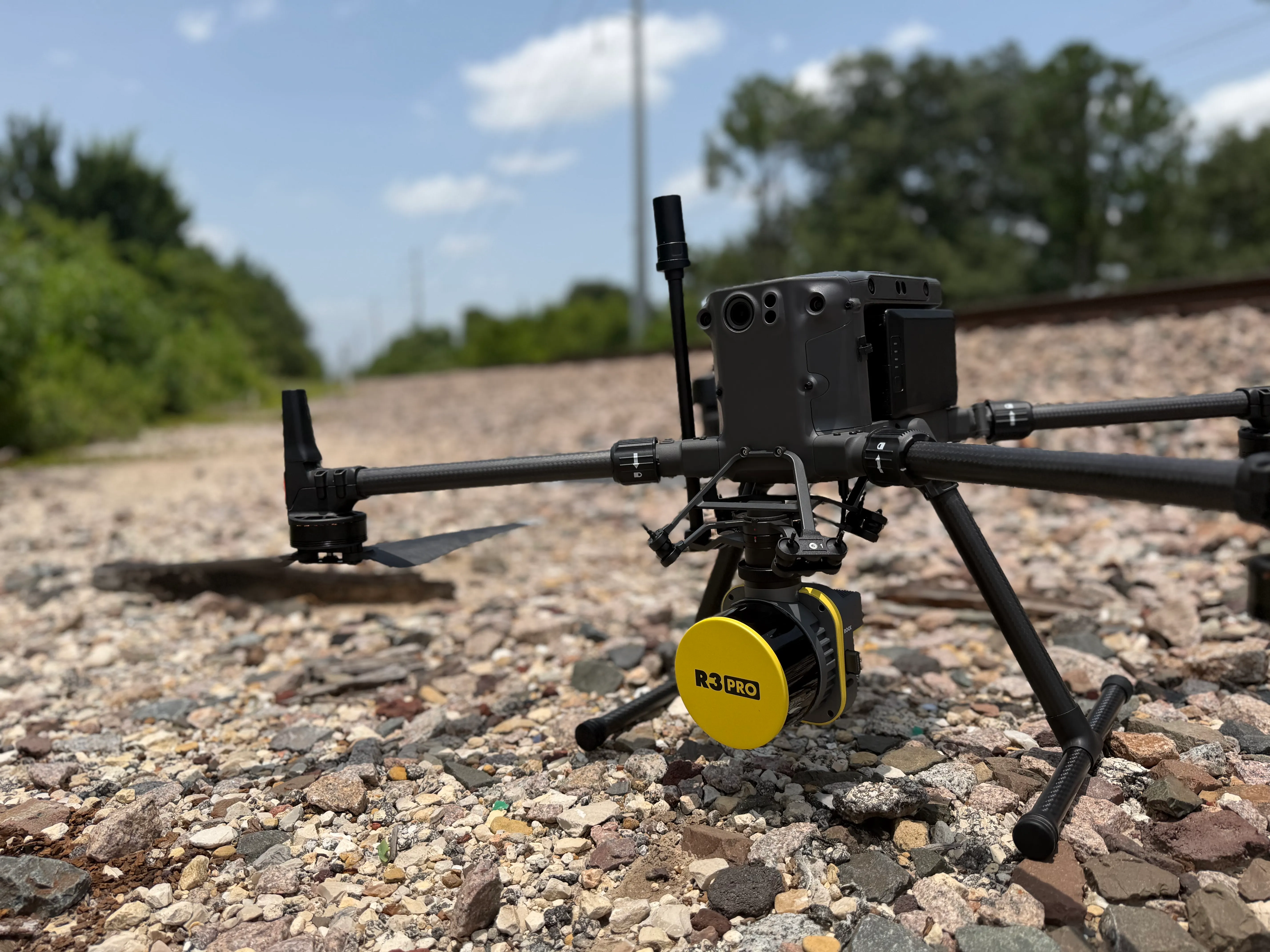
From LiDAR capture to cloud-ready deliverables.
Capture once. Deliver everything.
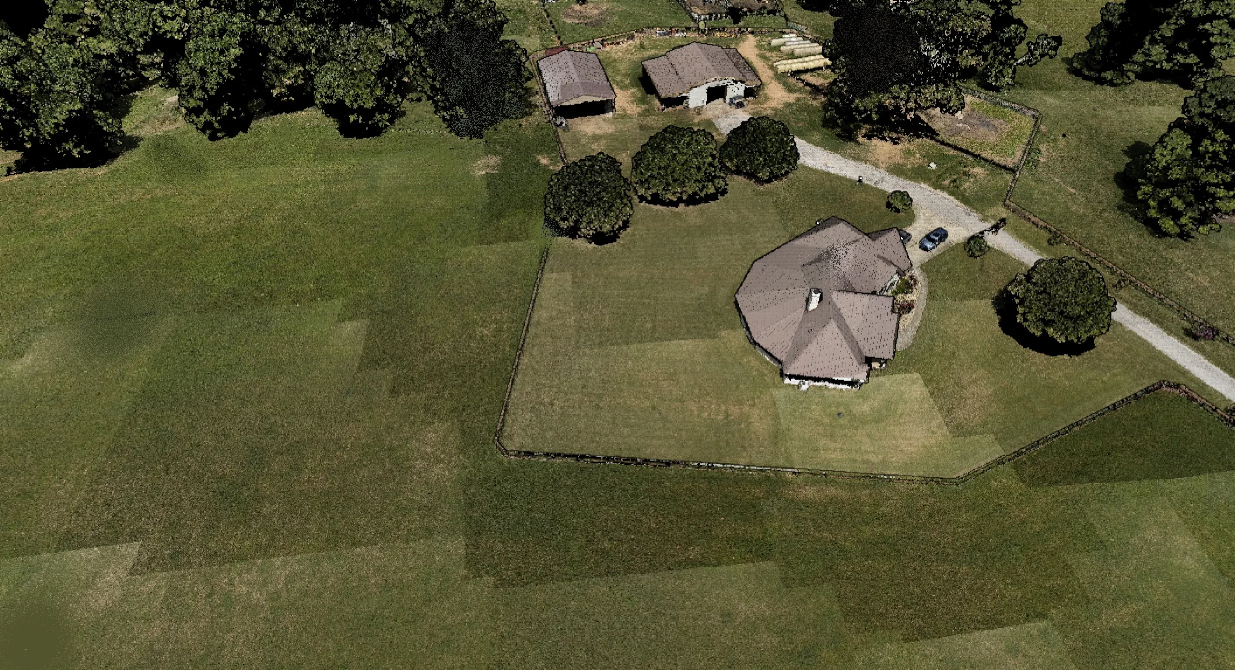
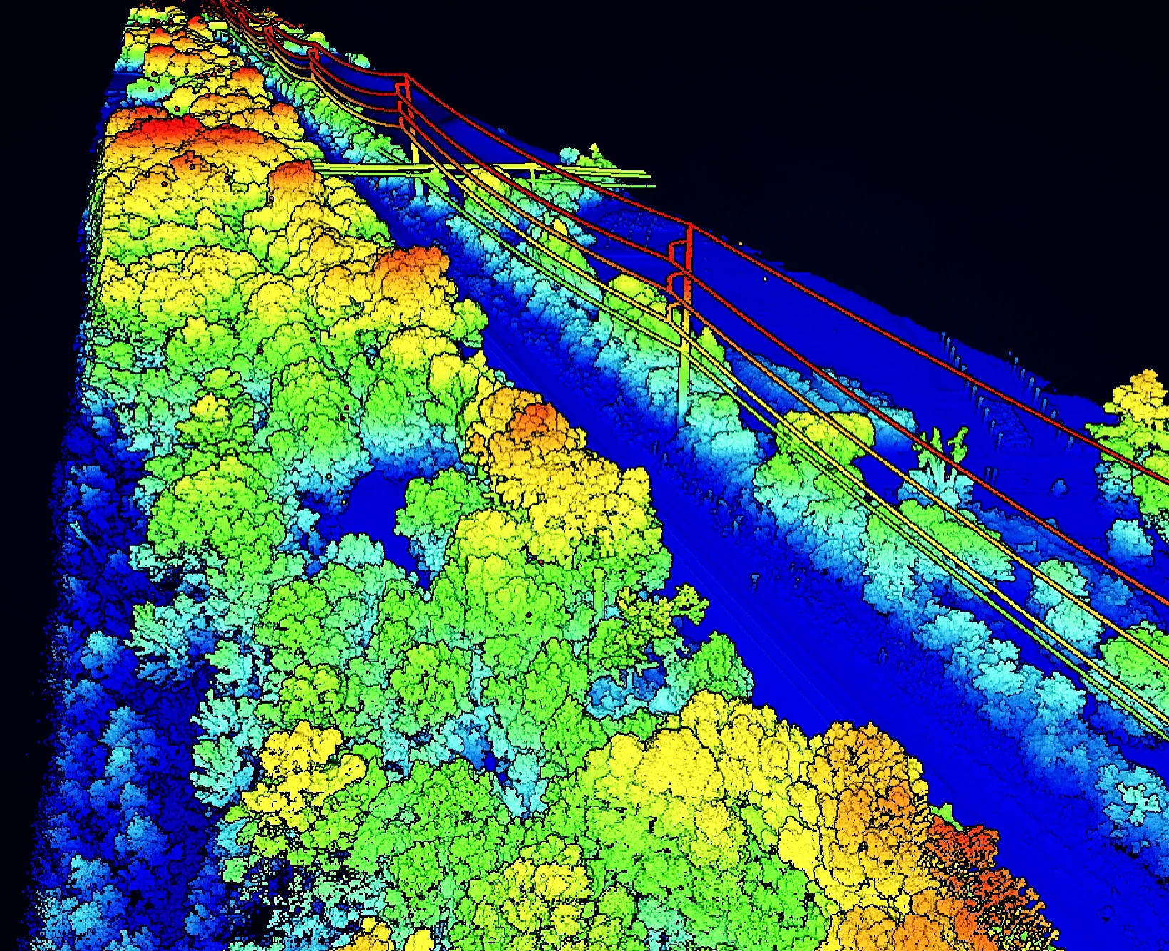
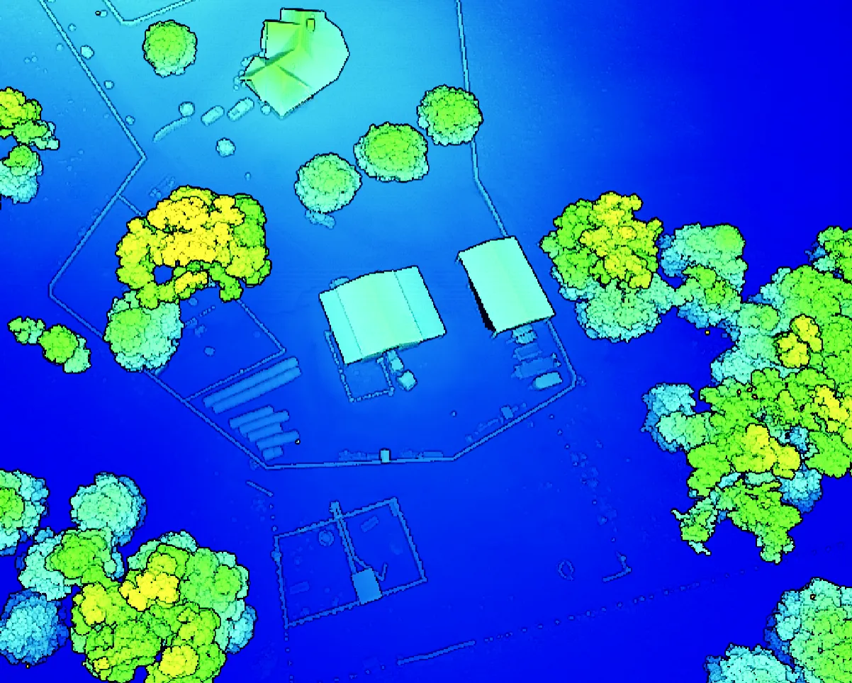
Axis Geospatial transforms aerial, mobile, and SLAM LiDAR data into engineering-ready deliverables for construction, utilities, rail, energy, and infrastructure projects. Our workflows generate high-density point clouds, terrain models, digital twins, and interactive cloud deliverables that integrate seamlessly with leading CAD, BIM, GIS, and construction platforms.
- Point clouds
- .LAS · .LAZ · .E57 · classified
- Terrain & surfaces
- DSM / DTM · contours · cross-sections
- Volumetrics
- cut / fill · stockpile reports
- Models & exports
- digital twins · BIM · CAD / GIS · 360°
Practical aerial outputs for Texas project teams.
- LiDAR & Geospatial Mapping
- ORTHO • DTM • VOLUMES
- Construction Progress Monitoring
- TRACKING • REPORTS • ANALYTICS
- Commercial Thermal Roof Inspections
- MOISTURE • ENVELOPE • DEFECTS
- Reality Capture & Digital Twins
- SLAM • BIM • AS-BUILTS
- Industrial Asset Inspections
- RAIL • UTILITIES • INFRASTRUCTURE
- Aerial Media & Cinematography
- VIDEO • MARKETING • INSIGHTS
Built for the way teams actually use aerial data.
Construction, engineering, land development, energy, agriculture, real estate, and public-sector teams all need different outputs. Axis starts with the decision you need to make, then scopes the flight and deliverables around it.
- MAPPING MISSIONS
- Orthomosaics, terrain models, contours, and measurable site imagery.
- CONSTRUCTION SITES
- Progress capture, earthwork documentation, stockpile snapshots, and site logistics views.
- INSPECTION FLIGHTS
- Roof, facade, utility, solar, and industrial asset documentation from safer vantage points.
- AERIAL MEDIA
- Clean aerial stills and motion assets for project marketing and stakeholder communication.
A clear path from site request to usable files.
- 01
Scope
Confirm location, acreage, access, deliverables, and project timeline.
- 02
Plan
Review airspace, site constraints, safety considerations, and capture method.
- 03
Capture
Fly repeatable mission patterns for mapping, inspection, or aerial media needs.
- 04
Process
Convert imagery into client-ready maps, models, reports, and media assets.
- 05
Deliver
Package files for owners, engineers, builders, marketers, or project managers.
Send a location. Get a flight plan.
Share the site, timeline, and intended use. Axis Geospatial will confirm the right capture method, deliverables, and next steps for your Houston-area project.
Most project briefs answered within two business days.